

Dan which the Book of Judges (Judges 18:27-29) states was known as Laish prior to its conquest by the Tribe of Dan, whereas in Joshua 19:47 it is called Leshem.
Beit Yeshua
Israel Trip
14 October 2011
Day 3
DAY 1
12 October 2011
DAY 2
13 October 2011
DAY 3
14 October 2011
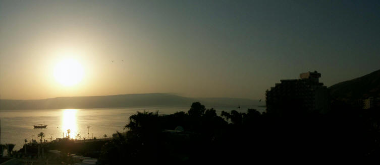
Sunrise on the
Kinneret in
TIBERIAS
Driving From
Tiberias toward
Tel Dan
Tel Dan
Nature Reserve
The Dan River
Pistacio Tree Lookout
Jeroboam's Altar
Lookout Post
Canaanite Gate
Israelite Gate
Caesarea
Phillipi
A Druze
Village
Lunch
Jordan River
Baptism
The
Golan Heights
Kinneret View
Dan
Asher
Meeting
Back to the
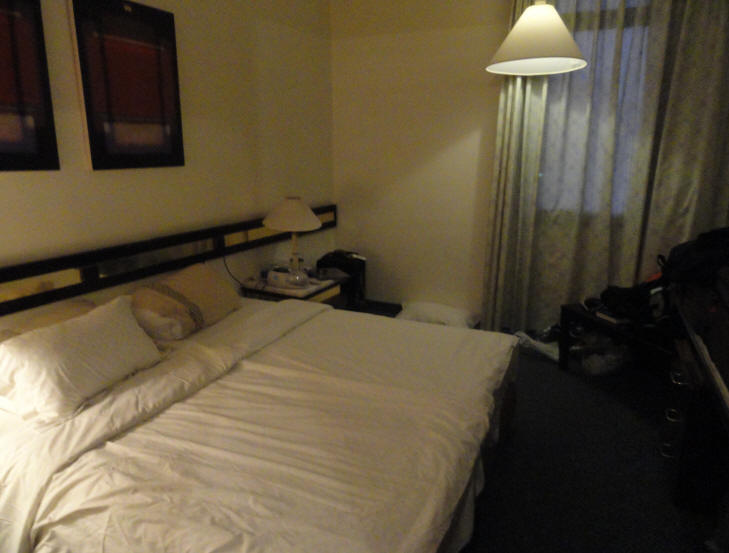
Room & Bed
DAY4
15 October 2011
DAY 5
16 October 2011
DAY 6
17 October 2011
DAY 7
18 October 2011
DAY 8
19 October 2011
DAY 9
20 October 2011
DAY 10
21 October 2011
DAY 11
22 October 2011
DAY 12
23 October 2011
Tiberias & the Sea of Galilee
John 6:1
After these things Jesus went over the sea of Galilee, which is the sea of Tiberias.
John 21:1
After these things Jesus showed himself again to the disciples at the sea of Tiberias; and in this way showed he himself.Mark 1:16-18
As Jesus walked beside the Sea of Galilee, he saw Simon and his brother Andrew casting a net into the lake, for they were fishermen. “Come, follow me,” Jesus said, “and I will make you fishers of men.” At once they left their nets and followed himMatthew 15:29-31
Jesus left there and went along the Sea of Galilee. Then he went up on a mountainside and sat down. Great crowds came to him, bringing the lame, the blind, the crippled, the mute and many others, and laid them at his feet; and he healed them. The people were amazed when they saw the mute speaking, the crippled made well, the lame walking and the blind seeing. And they praised the God of IsraelDay 3
Most of us were in bed by 10:00 pm last night. Since many hadn't slept well on the plane, they slept pretty good this first night. I was a bit jet-lagged, however, and even though I was in bed by 10:00 pm, I woke up at 3:00 am and couldn't go back to sleep. I eventually got out of bed at 3:30 am and spent some time reading my Bible and praying. I did go back to bed at 5:00 am but hadn't gone back to sleep when the alarm clock went off at 5:30 am.
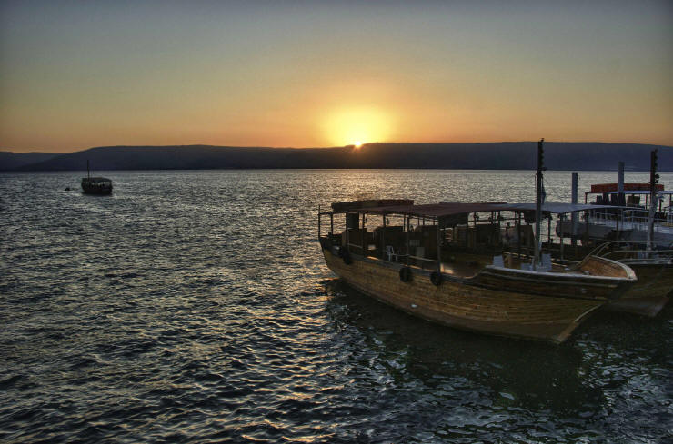
I wanted to see the sunrise over the Kinneret (Sea of Galilee) as I had done in 2005 so I dressed quickly and went downstairs to 1st floor balcony. The sun rose over the surrounding hills at 5:50 am. I stayed there till about 6:00 am, then went back to my room to shower and clean up for the day. Sunrise on the Kinneret
Thanks to Duke for this awesome Sea of Galilee sunrise photo
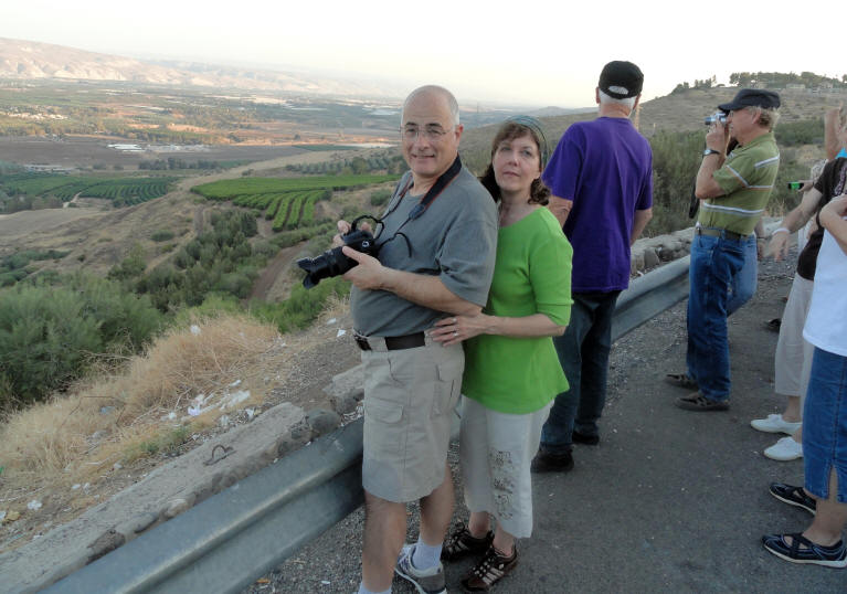
Everyone was on the bus by 8:30 am and the day began.
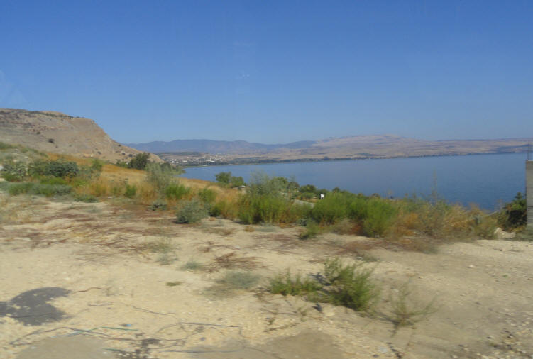
The Kinneret (Sea of Galilees) as we travel on the Sal El tour bus
Hillside homes in Tiberias
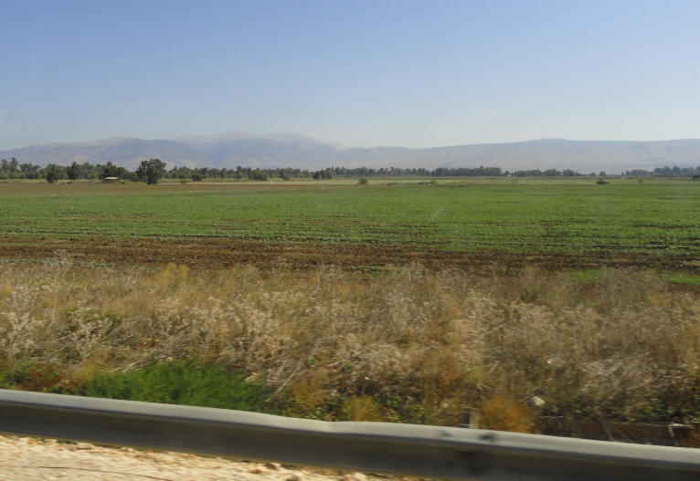
In spite of all the rocks, the Israeli soil is very fertile
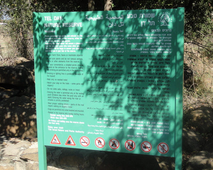
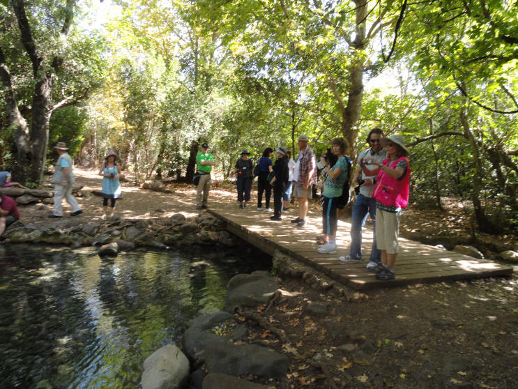
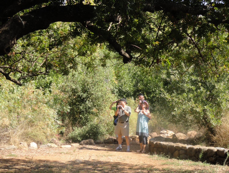
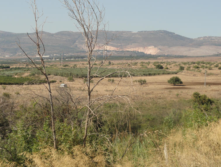
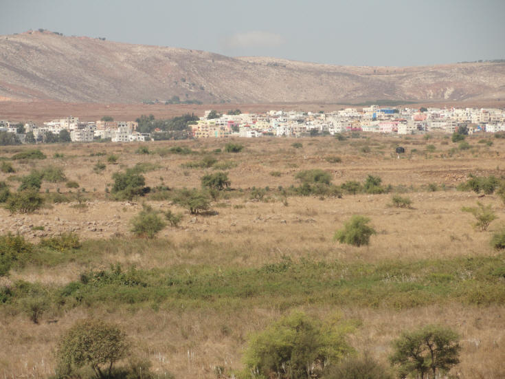
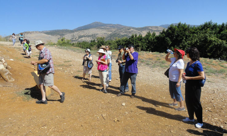
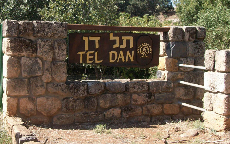
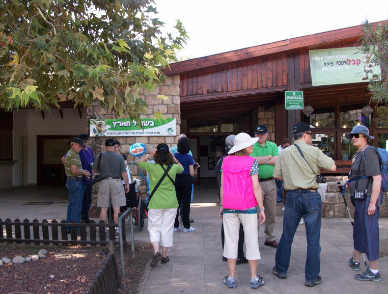
A little more than a mile from Kiryat Shmona is the Tel Dan Nature Reserve and sight of an important archaeological dig. To the west is the southern part of Mount Lebanon; to the east and north are the Hermon mountains. Tel Dan is about 50 acres in size and is located in the Golan Heights near Mount Hermon, the tallest mountain in Israel. The city dates back nearly 4,000 years to the days of the Canaanite rule. As a border town of the kingdom of Israel along the main trade route between Damascus and the Galilee, and the Dan River, one of the three main sources of the Jordan River, Dan was an important strategic outpost. Consequently, it became a battleground between Israelite forces and invaders from the north, such as the Assyrians. Today, the area is a nature reserve filled with poplars, eucalyptus, oak, pistachio and many other varieties of trees, ferns and flowers. Eucalyptus trees, which are not native to Israel, were originally brought into the country to help drain the swamps and are now being removed from some natural areas.
Entrance to the park
Tel Dan Nature Reserve
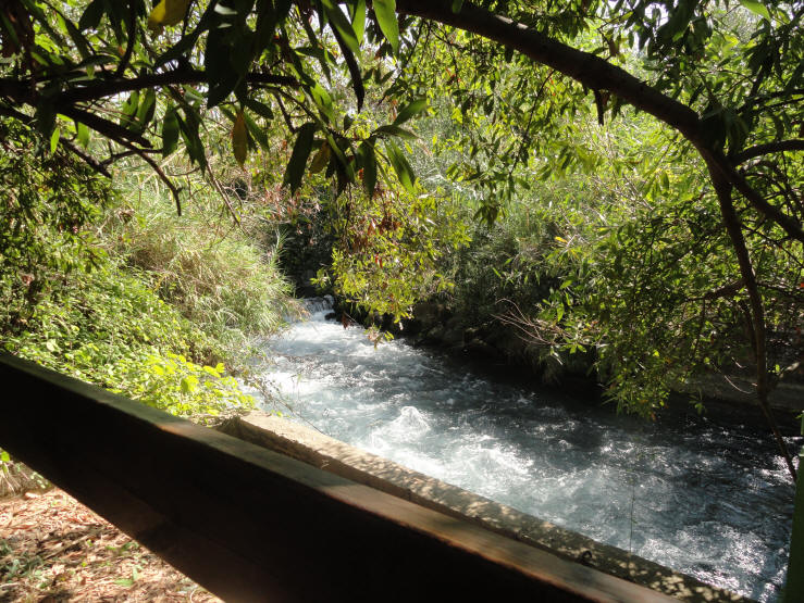
The Dan River is the largest and most important source of the Jordan River. Its springs provide water fed by the snow and rain on Mt. Hermon to the area. Because of its location Tel Dan is rich with plant life and animals.
The Dan source of the Jordan River in the Tel Dan Nature Reserve
From the Pistachio Tree Lookout you have a view of the reserve, the Hula Valley, the Naphtali Mountains, Mount Hermon and the Golan Heights. The lookout is named after the large Atlantic pistachio tree that grows there. The Pistachio Tree Lookout
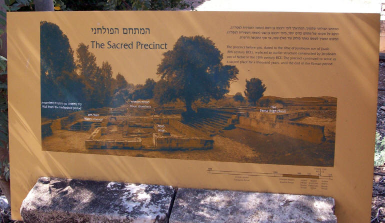
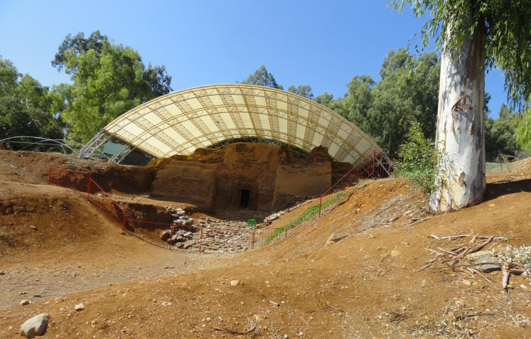
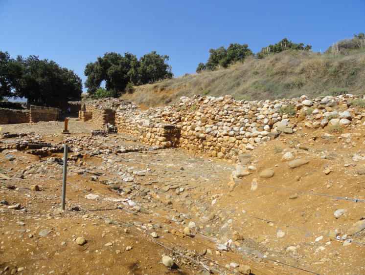
The temple at Tel Dan is the only surviving monumental temple complex from the Biblical kingdom of Israel. Although the temple features several phases of construction and adornment, the Hebrew Bible attributes its establishment to King Jeroboam I, who led the northern secession from Judah ca. 930 BCE to establish the independent kingdom of Israel. To prevent northerners from making pilgrimage to the temple in Jerusalem, we read in 2 Kings 12, that Jeroboam built new temples at Bethel (on Israel’s southern border) and at Dan (on the northern border). At each of these shrines, he set up a golden bull calf, calling them Elohim, the gods who brought the Israelites out of Egypt.
"The Sacred Precinct" The precinct before you, dated to the time of Jeroboam son of Joash (8th Centure BCE), replaced an earlier structure constructed by Jeroboam son of Nebat in the 10th Century BCE. The precinct continued to serve as a sacred place for a thousand years, until the end of the roman period.
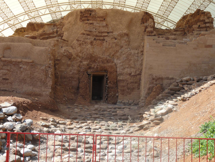
Left to Right: (1) Wall from the Hellenistic Period, (2) Water Resevoir, (3) Priest Chambers, (4) Altar, (5) High Place
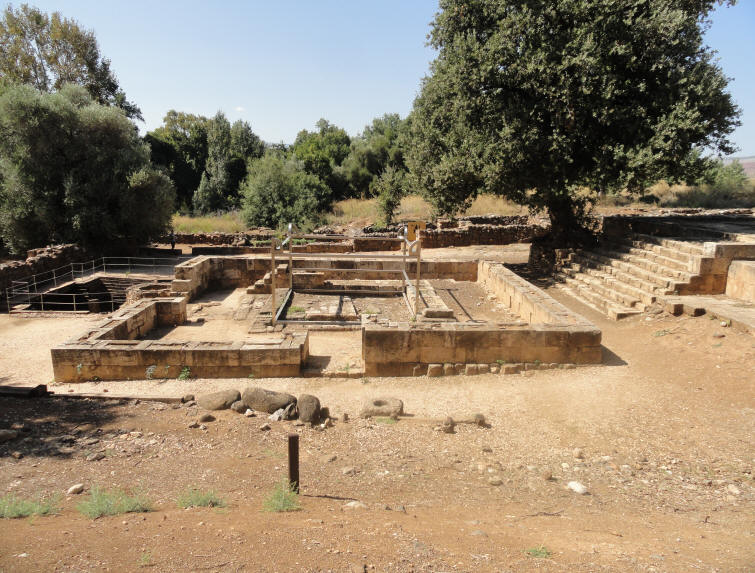
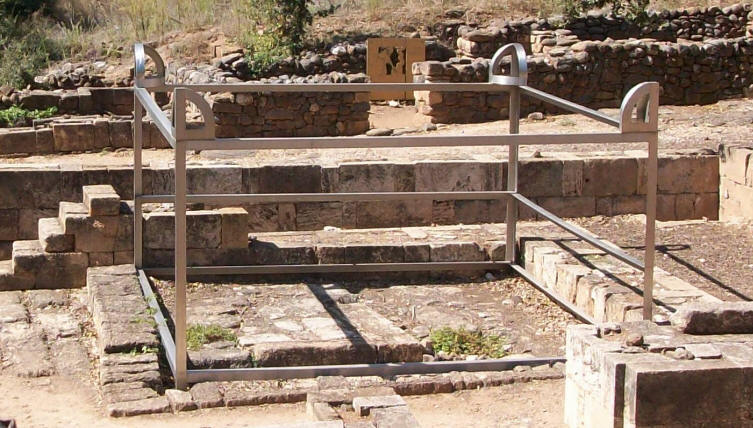
The Tel Dan High Place Alter built by King Jeroboam I
and scale model of Jeroboam's altar
The Golan Heights are very strategic in the security of Israel.
A pencil was responsible for the "Water War" between Syria and Israel. The British wanted the border between the British Mandate area of Eretz Israel and the French Mandate area of Syria and Lebanon to reflect the Biblical verse, "from Dan to Beersheva". The line north of Tel Dan was drawn in 1923. The border was drawn on the map with a leaded pencil. Both sides claimed sovereignty over the area covered by the pencil line, which represented 130 meters of land, including 'En Dan which flows nearby.
'En Dan is one of the most profuse springs in the Middle East.
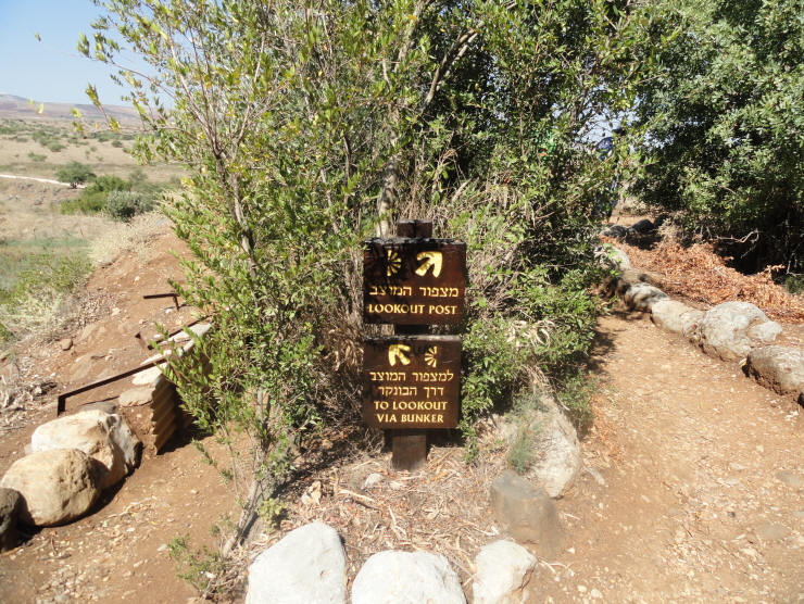
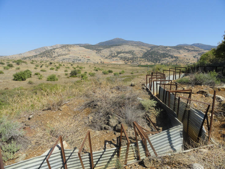
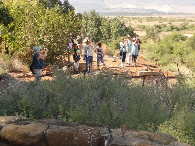
In 1964, Syria used the thickness of the pencil line as grounds to claim the right to draw water from the Dan. The Syrians built a post in the village of Nohila (400 meters across from here) and stationed tanks there. In response, the Israel Defense Forces paved the patrol road (which passes a few meters below here) and blocked Syrian access to the Dan springs. The Israeli armored forces also used the Tel Dan post, where we are presently standing, to prevent the Syrians from diverting the sources of the Jordan River. The conflict intensified and firing became a daily event. The most serious incident began on 13 November 1964. The Syrians shelled nearby Kibbutz Dan. The Israeli army reacted forcefully, bringing in the armored forces, the artillery and the air force, and eventually silenced the Syrian cannons and stilled the excavation equipment. Thus Israel prevented the sources of the Jordan River from being diverted.The Tel Dan Lookout Post and Lookout Post Bunker
The Lookout Post Bunker
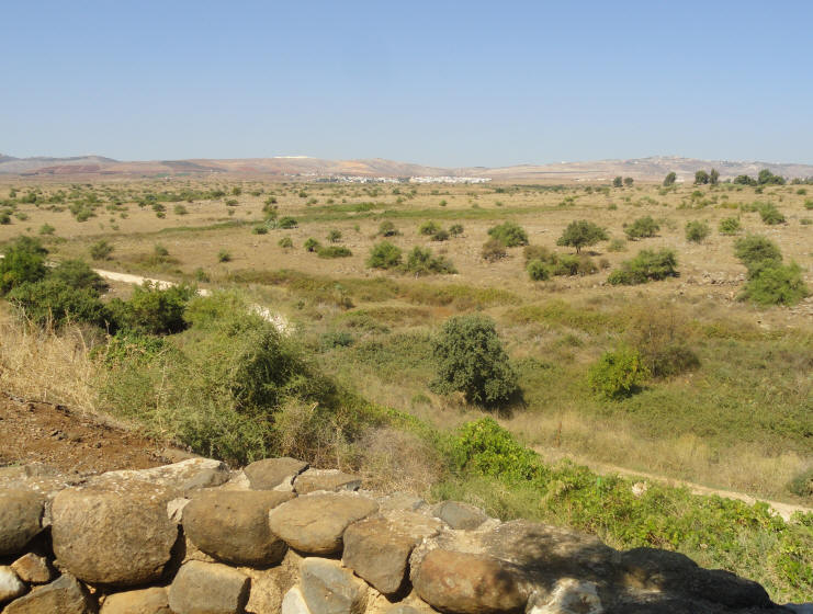
The Lookout Post
Looking toward Lebanon
Our Tour Guide, Pamela, talks about the Tel Dan area - CLICK HERE (7:57)
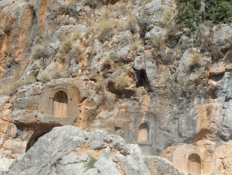
The Canaanite Gate, or "Gate of the Three Arches", was approached on a stepped path and was built with three arches. The arches, the piers supporting them, and the towers flanking the gate are constructed of sun-baked bricks and were covered with white plaster. The gate has survived to its full height of seven meters. Today it is possible to see only the outer arch.
The Canaanite Gate, AKA Abraham's Gate
Remains of the Iron Age Israelite Gate on the City's South Wall
Pamela's explanation of the Iron Age Israelite Gate, Video 1
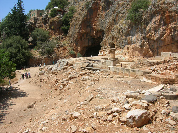
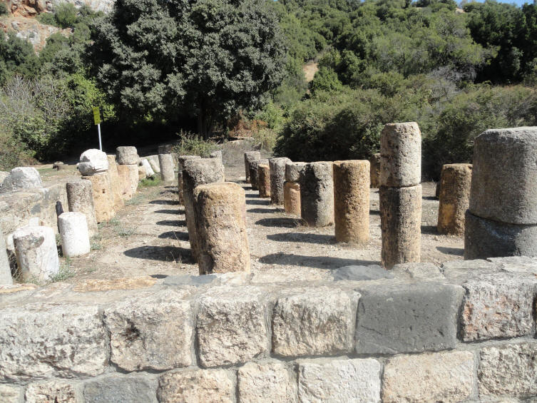
Caesarea Philippi was an ancient Roman city located at the southwestern base of Mount Hermon. The city is mentioned in the gospels of Matthew, and Mark. The city was located within the region known as the "Panion" (the region of the Greek god Pan) or Banais. Today, the city, now no longer inhabited, is an archaeological site located within the Golan Heights. In the Gospels, Yeshua is said to have approached the area near the city, but without entering the city itself. It was here that Yeshua asked his closest disciples what they thought of him. Accounts of their answers, including that of Peter, are found in the Books of Matthew, Mark, and Luke. Here Peter made his confession of Yeshua as the Messiah and the "Son of the living God".
A woman from this area who had been bleeding for 12 years, was miraculously healed by Yeshua when she touched the "wings" of his garment. Mt. Tabor is considered by many as the sight for the Transfiguration of Yeshua, but Caesarea Phillipi is considered a better location by many others. Caesarea Phillipi
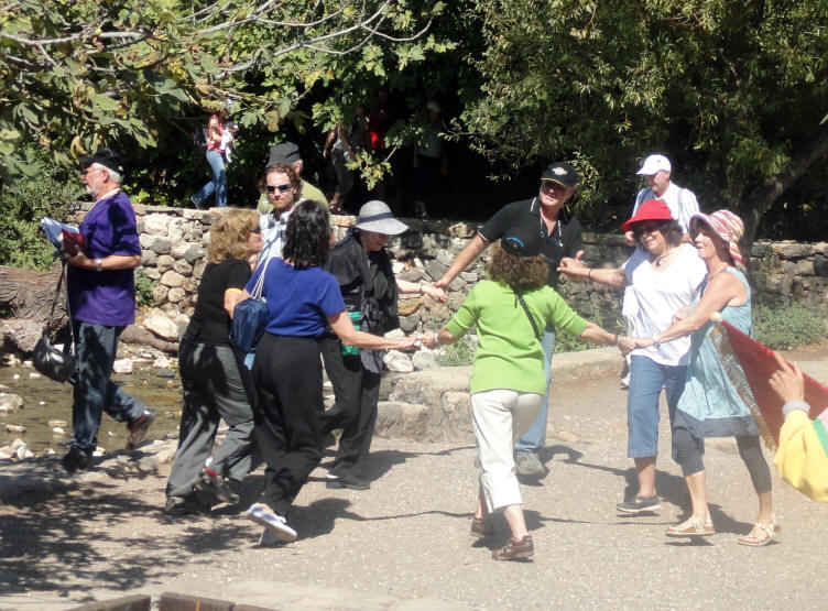
The ladies danced at Caesarea Phillipi while a group of Believers from
Indonesia sang and worshipped the Lord with flags & banners
Ancient ruins at Caesarea Phillipi (Banais)
Gid reads the Scripture from Mark 8 at Caesarea Phillipi
Mark 8:27
And Jesus went out, and his disciples, into the towns of Caesarea Philippi:
and on the way he asked his disciples, saying unto them, Who do men say that I am?Pamela talks about Caesarea Phillipi
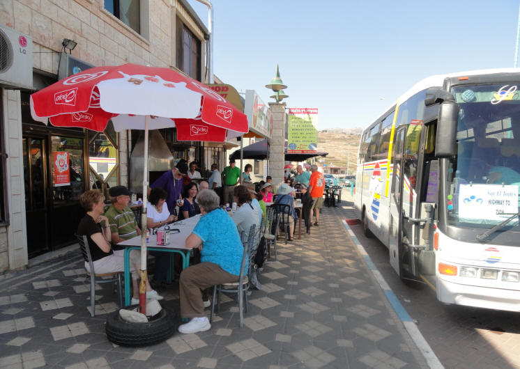
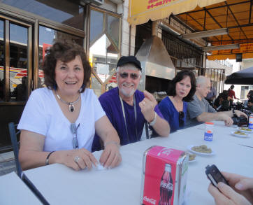
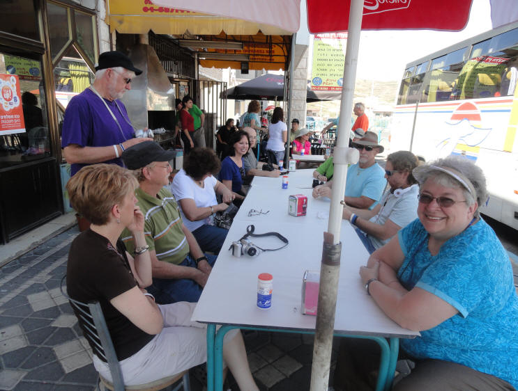
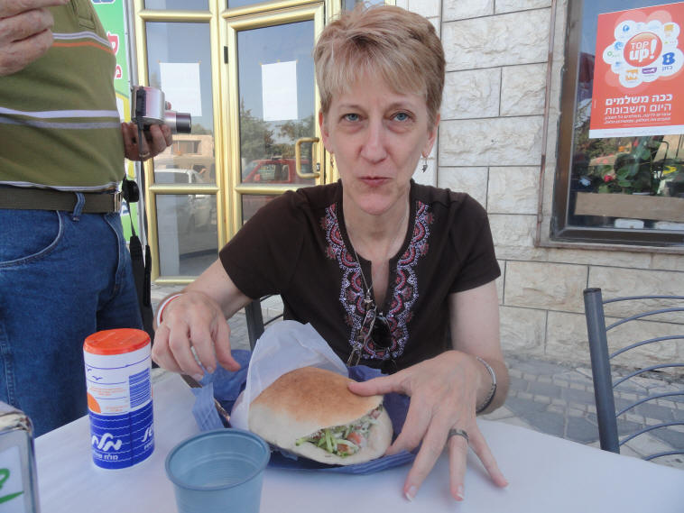
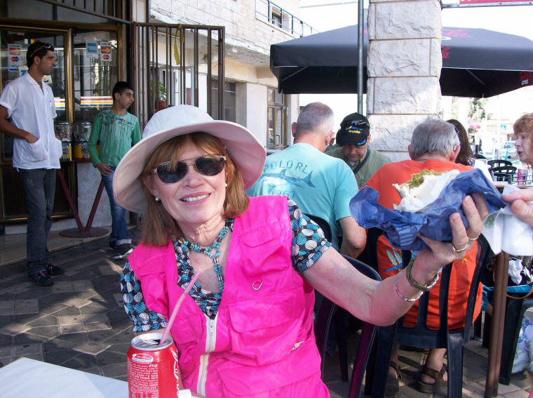
After touring all morning, we stopped at a Druze village for our first Falafel lunch. The Israeli Druze are mostly in Galilee (81%), around Haifa (19%), and in the Golan Heights, which is home to about 20,000 Druze. The Druze community in Israel is officially recognized as a separate religious entity with its own courts (with jurisdiction in matters of personal status - marriage, divorce, maintenance and adoption) and spiritual leadership. Their culture is Arab and their language Arabic but they opted against mainstream Arab nationalism in 1948 and have since served (first as volunteers, later within the draft system) in the Israel Defense Forces and the Border Police. The Druze in Galilee and on Mount Carmel have always kept in contact with the other branches of the community, especially with those of Mt. Hermon and Lebanon. During the British Mandate over Palestine they refrained from taking part in the Arab-Jewish conflict, and during Israel's War of Independence (1948) became active participants on Israel's side. A Druze Village Lunch for two - $20
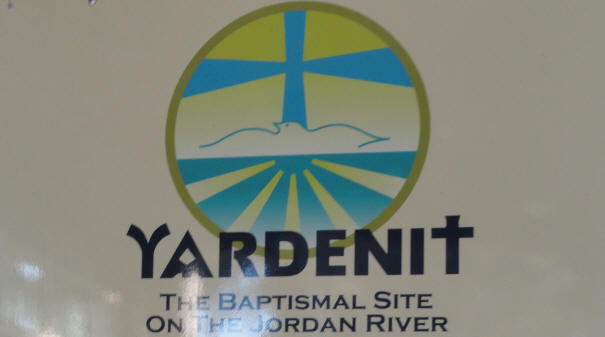
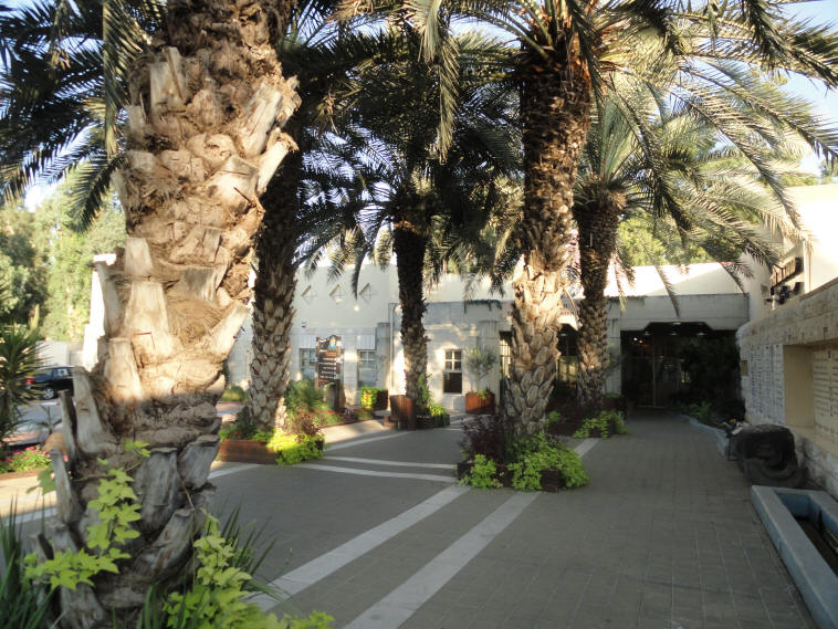
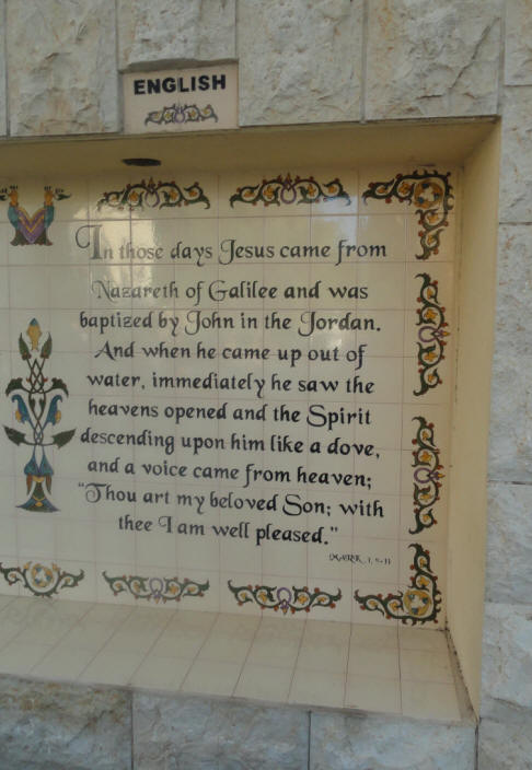
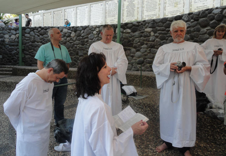
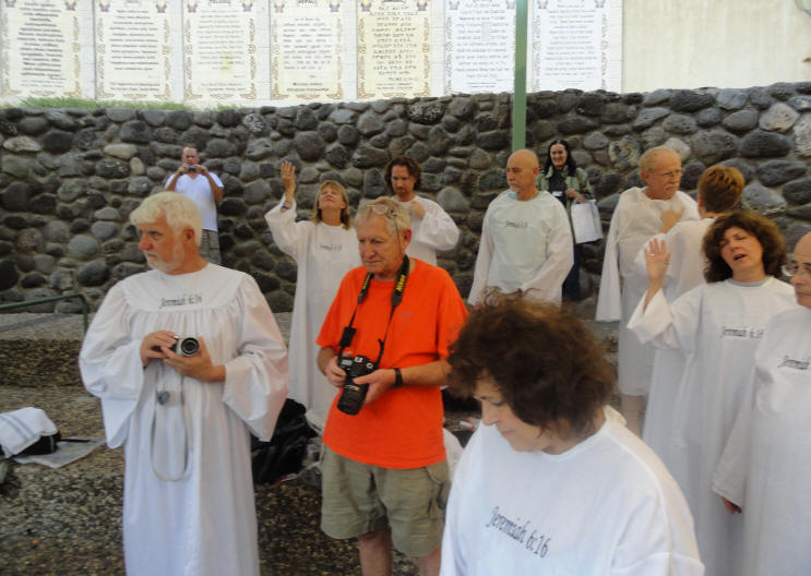
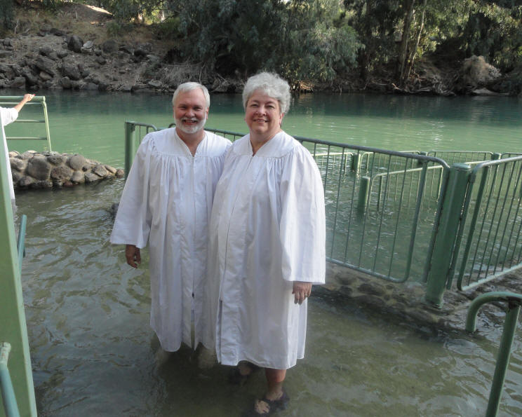
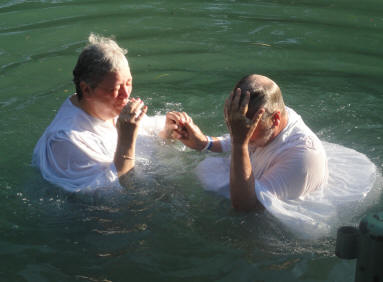
The mikveh was an important part of ritual purity for Jews as they prepared for temple worship. Even Yeshua participated in mikveh (baptism) as he began His ministry. In churches around the world, baptism is a part of a person's walk with the Lord with some churches baptizing children and others only baptizing after a person makes a profession of faith in Yeshua. In the traditional Jewish mikveh, the person wasn't immersed by someone else, but instead immersed themselves. Several of us had been baptized in the Jordan River during our 2005 trip to Israel, but Cathy shared how she always used the mikveh opportunity as a time of repentance and dedication before going up to Jerusalem. Her argument was so compelling that everyone decided to participate in the Jordan River mikveh (baptism). Yardenit - the Baptismal Site on the Jordan River
Cathy shared scripture as we prepared for the mikveh
Many of the married couples participated in the mikveh together - including Curtis & Carolyn
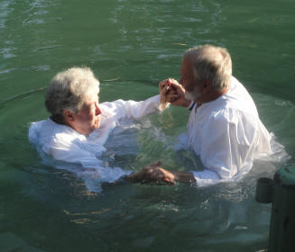
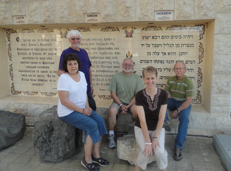
Posing for a photo after the mikveh
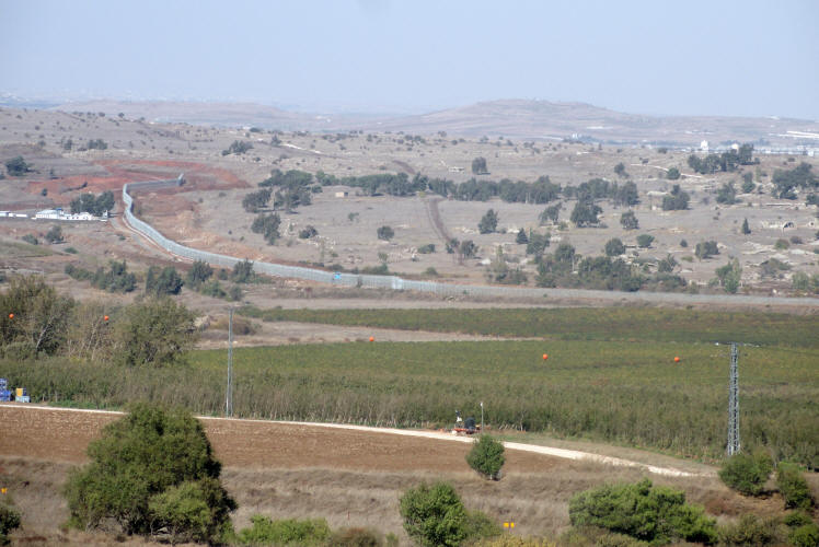
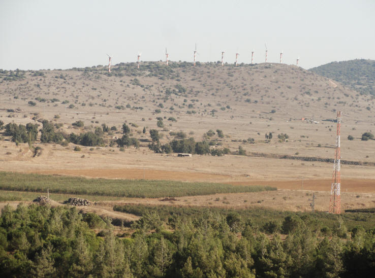
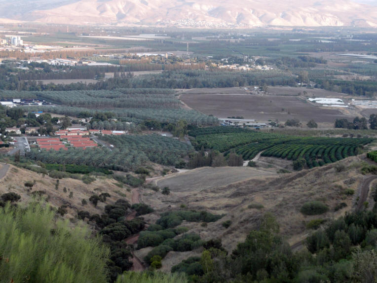
As we continued our tour of the Golan Heights, we pulled off for a scenic view toward Syria. Notice the Security wall separating Israel for Syria and the Golan Heights Wind Farm. The Golan Heights Wind Farm is an Israeli wind farm located 1050 m above sea level on Mount Bnei Rasan 5 km south of Quneitra in the Golan Heights.
The separating wall between Israel and Syria
The Golan Heights Wind Farm
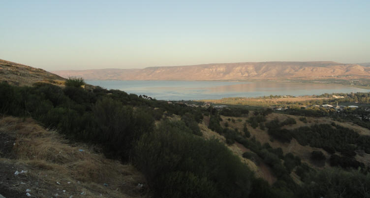
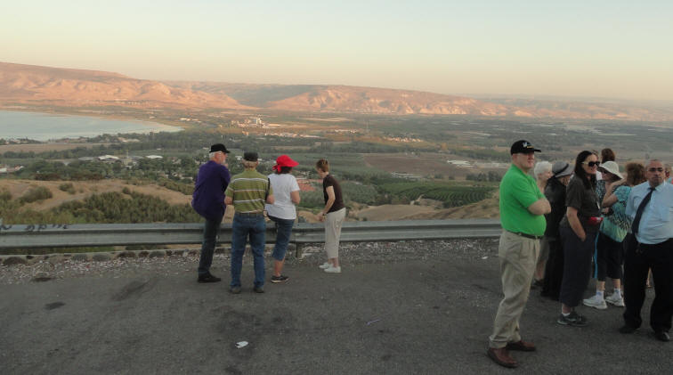
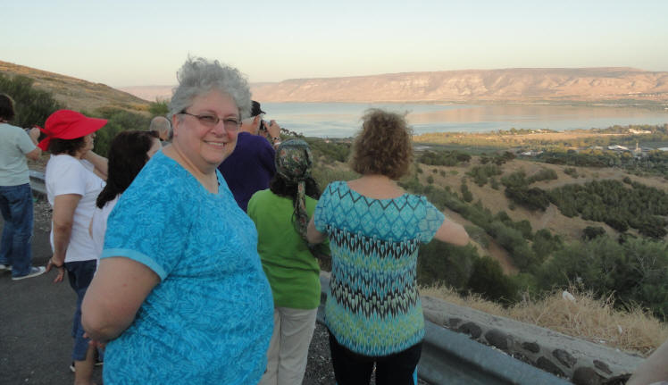
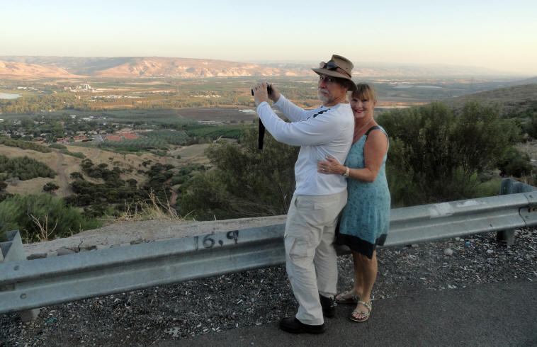
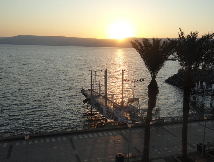
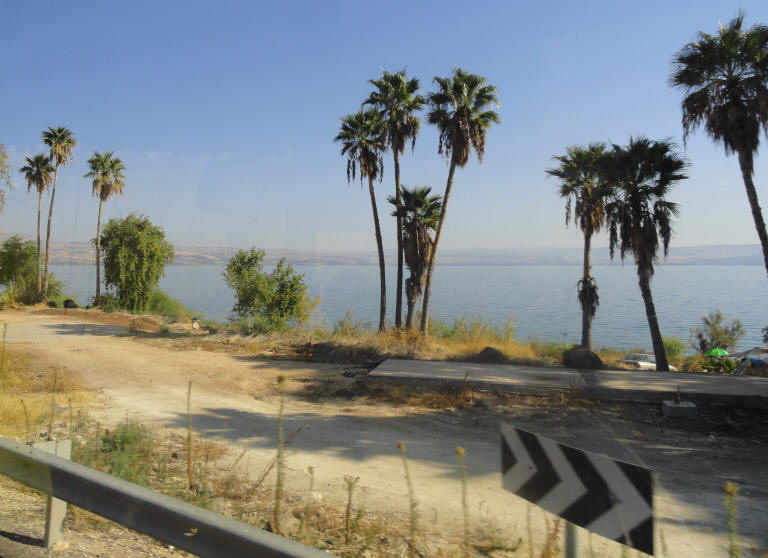
Our tour on Day 3 (Friday, Oct 14, 2011) concluded with a drive around the Kinneret (Sea of Galilee) with a wonderful panoramic view of the lake.
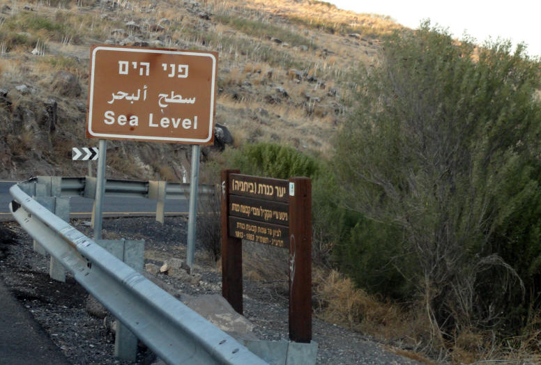
The Sea of Galilee, also Kinneret, Lake of Gennesaret, or Lake Tiberias is the largest freshwater lake in Israel, and it is approximately 33 miles in circumference, about 13 miles long, and 8.1 miles wide. The lake has a maximum depth of approximately 141 feet. At 702 ft below sea level, it is the lowest freshwater lake on Earth and the second-lowest lake in the world after the Dead Sea. The lake is fed partly by underground springs although its main source is the Jordan River which flows through it from north to south.
Israel's National Water Carrier, built in 1964, transports water from the lake to the population centers of Israel, and is the source of much of the country's drinking water. In 1964, Syria attempted construction of a Headwater Diversion Plan that would have blocked the flow of water into the Sea of Galilee, sharply reducing the water flow into the lake. This project and Israel's attempt to block these efforts in 1965 were factors which played into regional tensions culminating in the 1967 Six-Day War. During the war, Israel captured the Golan Heights, which contain some of the sources of water for the Sea of Galilee. Under the terms of the Israel–Jordan peace treaty, Israel also supplies 50 million cubic meters of water annually from the lake to Jordan. Increasing water demand and dry winters have resulted in stress on the lake and a decreasing water line, at times to dangerously low levels. The Sea of Galilee is at risk of becoming irreversibly salinized by the salt water springs under the lake that are limited by the weight of the freshwater on top of them. Kinneret view from Sea Level Lookout
Sea Level Overlook
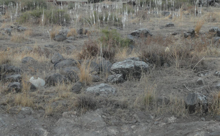
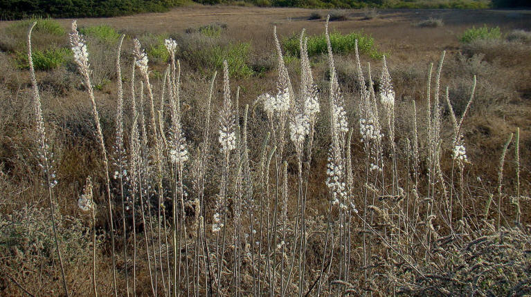
The Sea Squill's appearance is a sure sign that summer ends and fall arrives
and is the first flower to appear with the fall rains
Video view of the Kinneret from the lookout
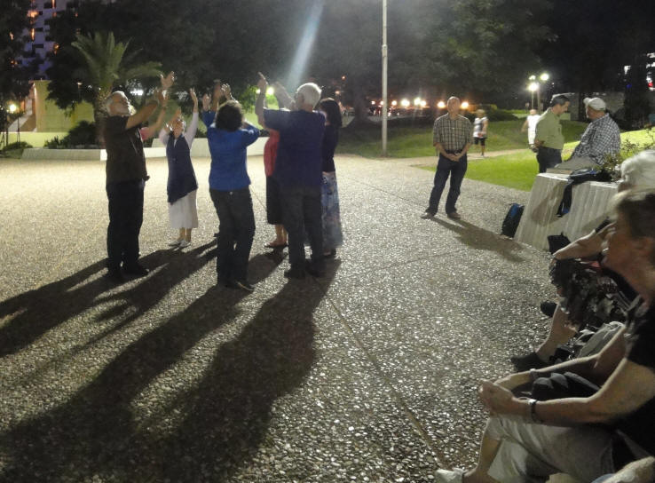
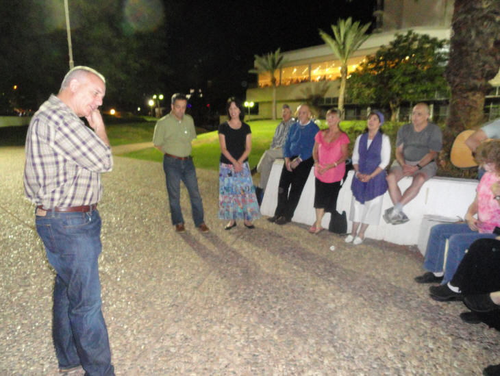
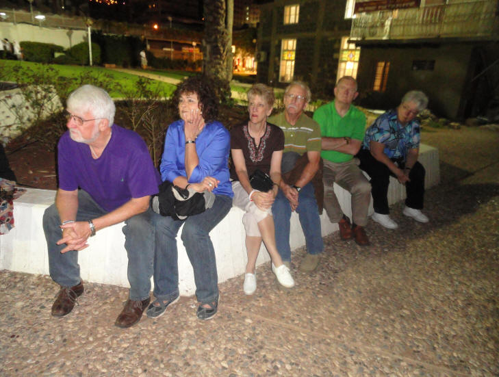
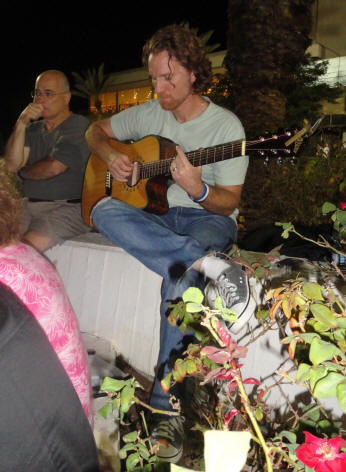
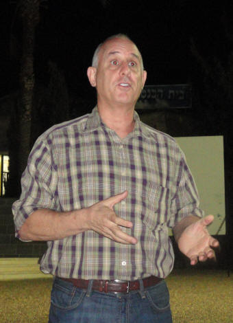
After dinner we left the hotel and Tiberias and looked for a place outside where we could share, sing, dance and listen to Dan Asher share. Several of us had known Dan from when he had lived in Charlotte, NC, before making Aliyah to Israel. As Gideon played the guitar and led everyone in praise and worship, the dancers danced. Dancing behind the old Beit Knesset in Tiberias
Dan Asher shared about his work in Israel
We concluded the day and were finally back in the room and ready for bed at 10:00 pm - with plans for a 5:30 am wake-up the next morning. Our hotel room at the Caesar Permier in Tiberias
More Photos and Information From the 2011 Sukkot Trip
Day 2 - 13 Oct 2011 Day 3 - 14 Oct 2011 Day 4 - 15 Oct 2011 Day 5 - 16 Oct 2011 Day 6 - 17 Oct 2011 Day 7 - 18 Oct 2011 Day 8 - 19 Oct 2011 Day 9 - 20 Oct 2011 Day 10 - 21 Oct 2011 Day 11 - 22 Oct 2011 Day 12 - 23 Oct 2011